California’s Rural Populations Map
By Pamela Rasada & Britnee Pannell
The Rural Zones Interactive Map was developed by the California Research Bureau (CRB) at the request of the Senate Committee on Agriculture. The map highlights data specific to California’s rural areas by county and legislative district, and allows for an easy view of California’s most rural areas. CRB typically uses the U.S. Health Resources & Services Administration definition for identifying rural areas as it provides a more balanced approach than the U.S. Census or Office of Management and Budget, which focus on whole counties, even if they have a mix of urban and rural areas.
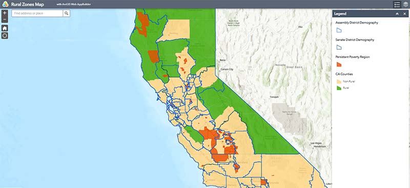
In using the tool, note that the upper-right corner includes two buttons: Click on the Legend button to view what the various colors represent. Use the Layer List to choose your view, Senate Districts, Assembly Districts, or both! Click on each county to see the name of the Assembly and Senate representatives as well as county data detailing: total population, civilian population over 18, residents 65+, veterans, total households, percentage of households with computers, and householders living alone. For questions, please email crb@library.ca.gov.
We hope this tool is helpful to California policymakers and their staff as they work on policy strategies (examples of state policy strategies from NCSL) to address the unique challenges (Pew research on unique challenges of rural areas) and problems rural communities face.